Welcome to Linyuan Li’s (李林源) personal academic website! Visit it and enjoy it!
What I devote myself to
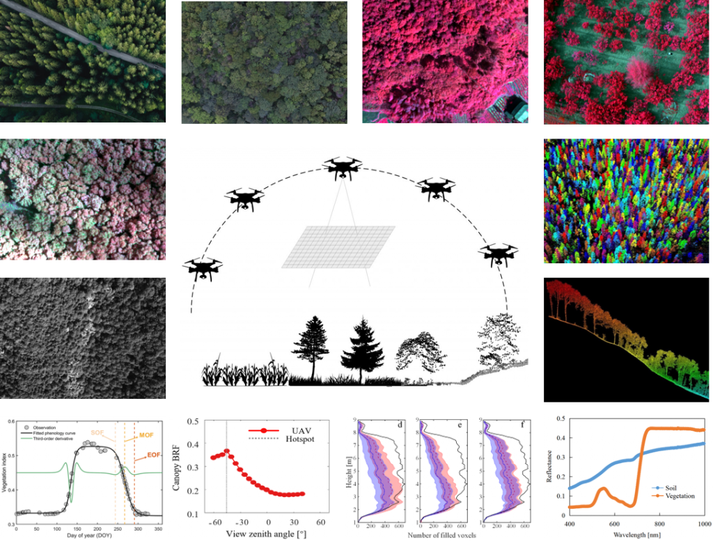
Remote sensing is changing the way that we see the world. Large-scale remote sensing gives us a better understanding of global change, while fine-scale near-surface remote sensing gives us a more accurate picture of the heterogeneity and dynamics of the land surface. Given that very-high-resolution satellite constellations and UAV platforms can provide unprecedentedly fine observations, I want to answer the following critical scientific questions:
- 1. How can the existing remote sensing theories and methods be made applicable to fine-scale observations? How to address the unique issues associated with fine-scale remote sensing modeling and retrieving?
- 2. How to fully explore the potential of finely-temporospatial multi-modal observations to advance remote sensing models and improve the accuracy of vegetation variables retrieval?
- 3. How to further apply remote sensing techniques in practical applications, such as natural resource surveys, forest ecosystem function evaluation, crop breeding, etc.
Who I am:
I am a young remote sensing scientist who integrates fine-scale (ultrahigh-resolution UAV and very-high-resolution satellite) observations, theory, and modeling to improve the vision when we see plants, vegetation communities, and ecosystems.
What I use:
Both low-cost techniques (e.g., RGB camera, photogrammetry) and advanced techniques (e.g., multispectral camera, hyperspectral imager, and LiDAR) are used individually or integrately. Radiative transfer theory and models (e.g., 1D models and 3D models) are fundamental principles in our community. Modern computer vision techniques (e.g., deep learning, ray tracing) are involved in my research.
The institutes that have supported my studies
Visitor map