(Edit: 2026-07-06)
Research Framework
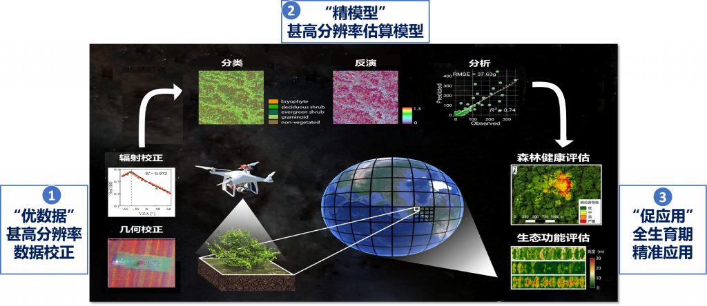
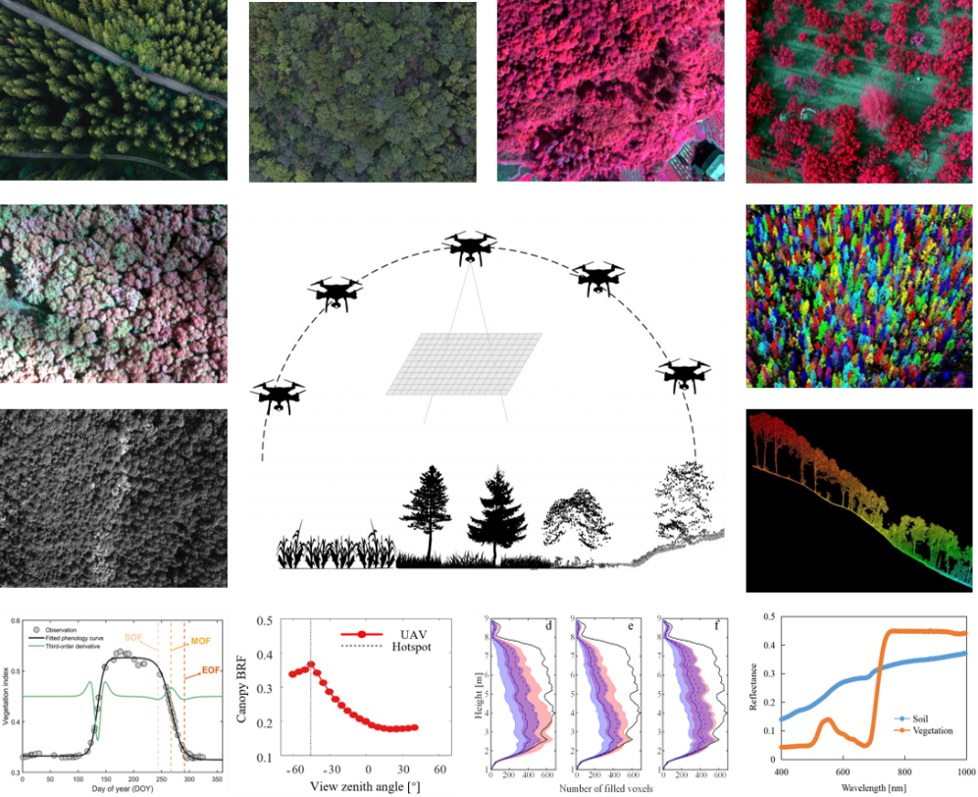
High-quality radiometric and geometric correction for multi-modal data (image and LiDAR)
High-quality analysis-ready data is the prerequisite of vegetation variable retrieval and further applications. We intend to develop a range of methods to radiometrically and geometrically correct the raw UAV data (spectral imagery and LiDAR) to a highly reliable reflectance factor, point cloud, or waveform, where the varying illumination effect, BRDF effect, radiometric inconsistency, geometrical mismatches, and georeferencing issues are considered.
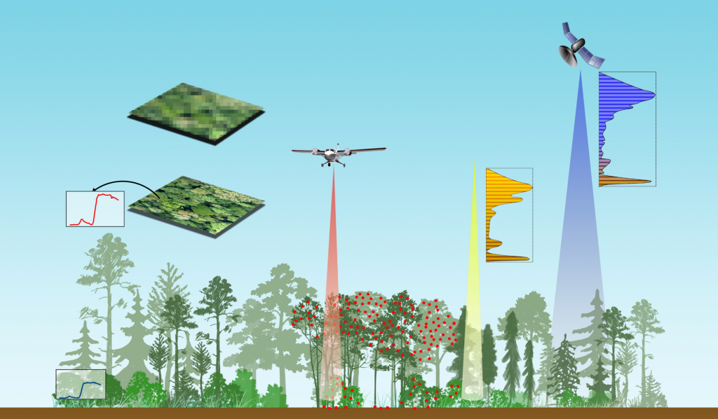
Ultra-high-resolution retrieval of vegetation variables (traits)
To better monitor canopy structure and function at very fine scale, we develop algorithms to estimate fractional cover (fCover), leaf area index (LAI), fractional intercepted photosynthesis active radiation (fIPAR), and advanced biochemical traits such as water content and leaf chlorophyll content (LCC), using a wide range of sensors (RGB, multispectral/hyperspectral camera, LiDAR, thermal camera, etc.).
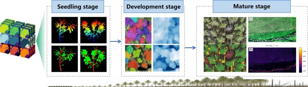
RS-based Lifecycle precision forestry application paradigm
Reconstructing a UAV-oriented forestry indicator system goes beyond simply translating traditional forest metrics into remote sensing products. It redesigns the indicator framework to fully exploit the strengths of multi-source UAV observations while preserving the ecological and silvicultural essence of conventional forestry. We intend to overcome the long-standing bottleneck in converting remote sensing data into actionable forestry information, enabling precise, life-cycle-wide forest management decisions.
Research Projects
- 北京市高创计划·科技新星项目,2026-2029,北京市科技委员会,40万元,主持,在研
- 基于机载激光雷达与光学影像的林下植被关键参数反演 ,2026-2029,国自然基金委面上项目,47万元,主持,在研
- 突发事件生态损害遥感响应特征知识库系统构建,2025-2027,科技部重点研发专题,50万元,主持,在研
- 基于无人机遥感的单木尺度叶面积指数与叶绿素含里反演研究,2022-2024,国自然基金委青年项目(C类) ,30万元,主持,结题
- 基于无人机影像与点云融合数据的森林冠层覆盖度估算,2020-2022,博士后基金面上项目,8 万元,主持,结题